How vegetation has a direct connection with rainfall patterns, as part of research on cooling the planet with native perennial vegetation HERE
By Craig Dremann, The Reveg Edge, Box 361, Redwood City, CA 94064 USA
Google Earth Images on this web page used under the Google Earth agreement, scan from the Bent's 1900 map, Salalah vegetation and water photo from Oman Attractions with written permission.and NASA Infrared satellite image.
Phone (650) 325-7333 email
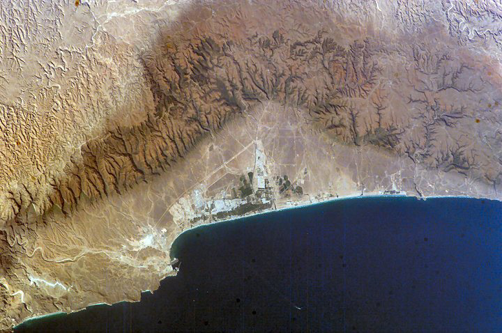
NASA image of the Salalah area in the Sultanate of Oman, the brown areas are where the vegetation and precipitation occurs in the summer during the monsoon season.
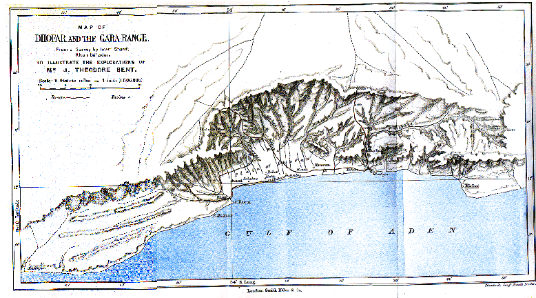
One of the first detailed maps of the region, from James Theodore and Mabel Bent's travels in their book, Southern Arabia (1900) (Check for availability online at http://www.gutenberg.org/ for example)
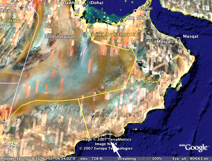
Salalah from 800 miles up, from Google Earth
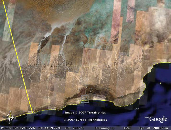
Salalah from 200 miles up, from Google Earth.
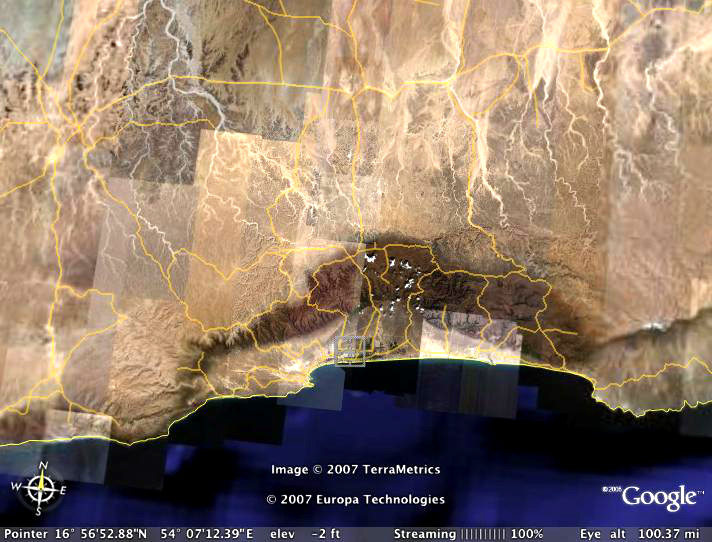
Salalah from 100 miles up, from Google Earth
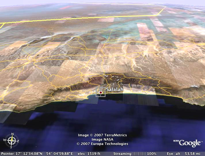
Salalah from 50 miles up, from Google Earth
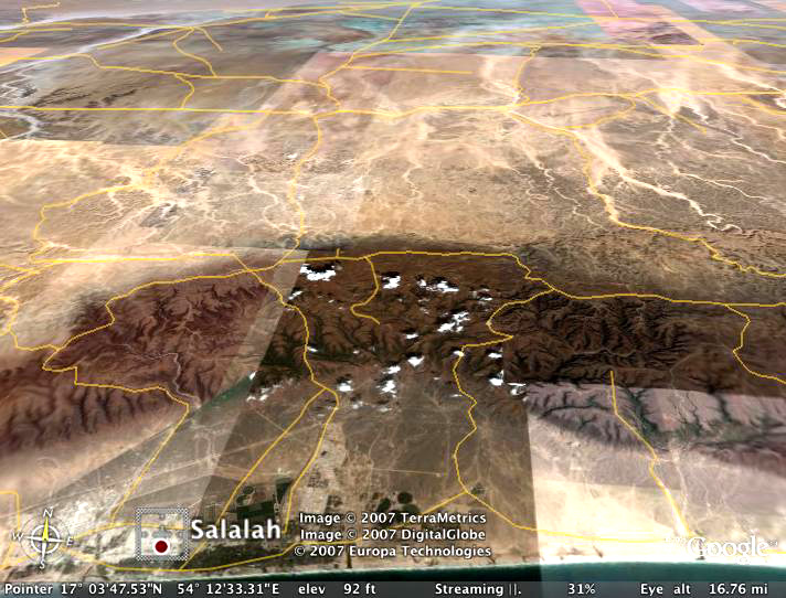
Salalah 15 miles up, from Google Earth, the lighter colored background is the Empty Quarter, one of the most barren places on earth.
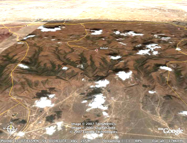
Salalah about 3 miles or 17,000 feet up, from Google Earth, showing the sharp edge between barren and vegetation.
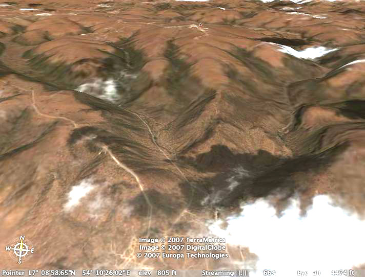
Salalah from 800 feet up, from Google Earth.
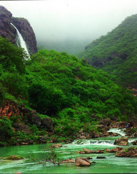
Salalah vegetation and water. Photo copyright © by Oman Attractions., used with written permission.
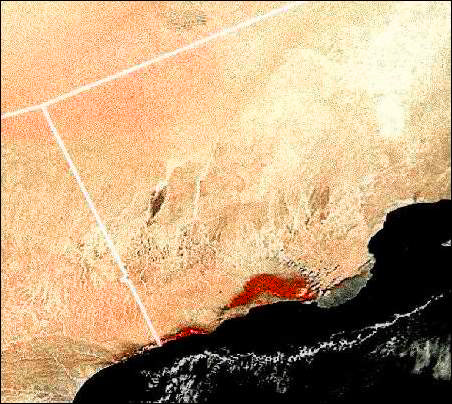
NASA infrared satellite photo of the area, showing the vegetation in red. Notice that even though the area outside of the mountains around Salalah looks barren, the satellite is still picking up some vegetation evenly spaced in about half of the photo, as a pink blush.
Updated December 24, 2022 - The Reveg
Edge Ecological Restoration service