About 20 braids worth per 1/2 pound.
Sue and
Craig Dremann's Excellent
March and April 2008 California Wildflower Adventures
Photos copyright © 2008 by Susan and
Craig Dremann, text copyright © 2009 by Craig Dremann from
Notebook 215, pages 52-55, all right reserved including the web,
or any other image storage or transmission technologies.
Box 361, Redwood City, CA 94064 (650) 325-7333
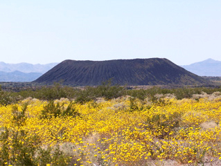
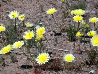
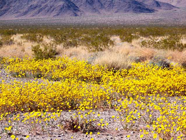
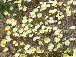
Amboy volcano crater and desert daisies
Amboy crater desert daisies
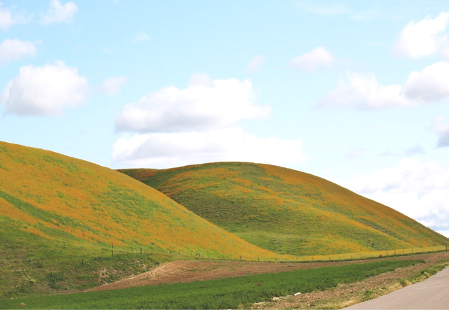
San Luis Obispo county Amsinckia
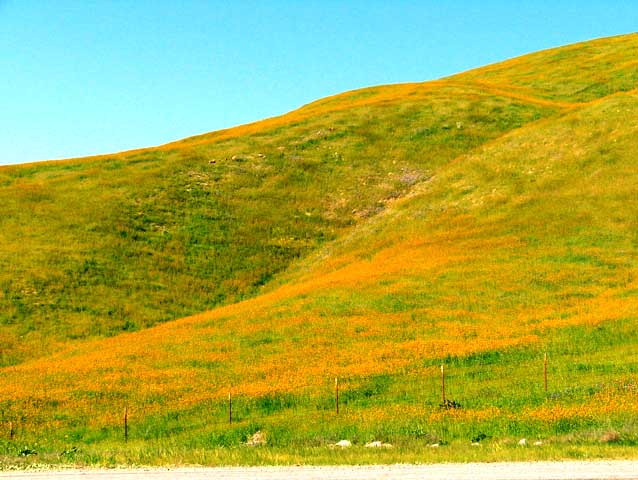
Hwy 46 Amsinckia
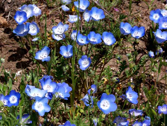
Highway 58 Baby Blue Eyes
Hwy 58 Coreposis
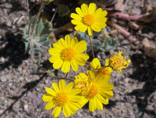
Desert dandelions
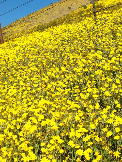
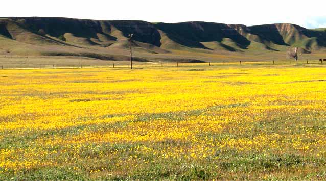
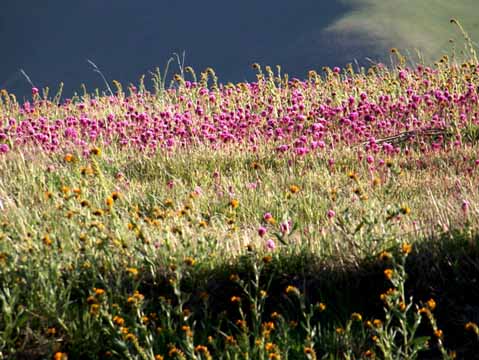
Hwy 58 Goldfields
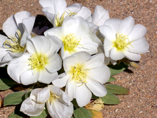
Mojave dune evening primroses
 San
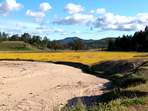
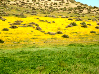
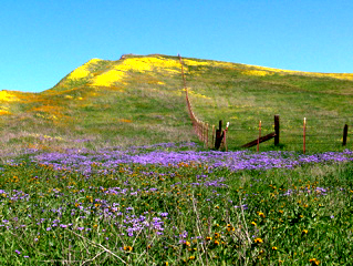
Luis Obsipo county Goldfields
San
Luis Obsipo county Goldfields
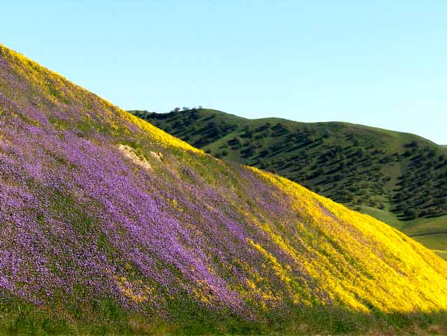
..and more Goldfields
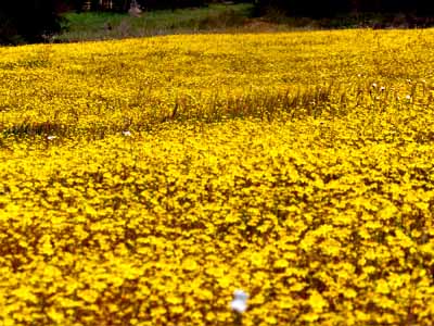
...and even more Goldfields
Hwy 46 Phacelia, Amsinckia & Coreopsis (from front to back)
...more Hwy 46 Phacelia and coreopsis
Hwy 58 Layia
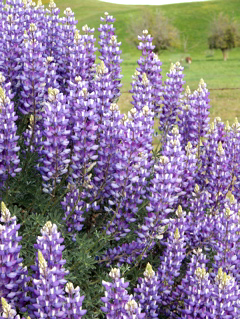
Bush lupine
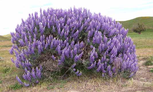
Bush lupine
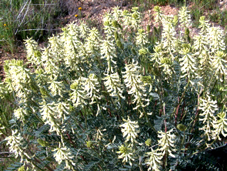
Hwy 58 Locoweed or Milkvetch
Interstate 40 Desert daisies
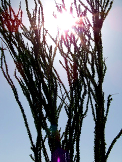
Joshua Tree NP- Ocotillo plant
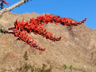
Joshua tree NP - Ocotillo flowers
Hwy 58 Owls clover and Amsinckia
Hwy 58 owls clover
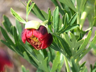
Hwy 58 Paeonia
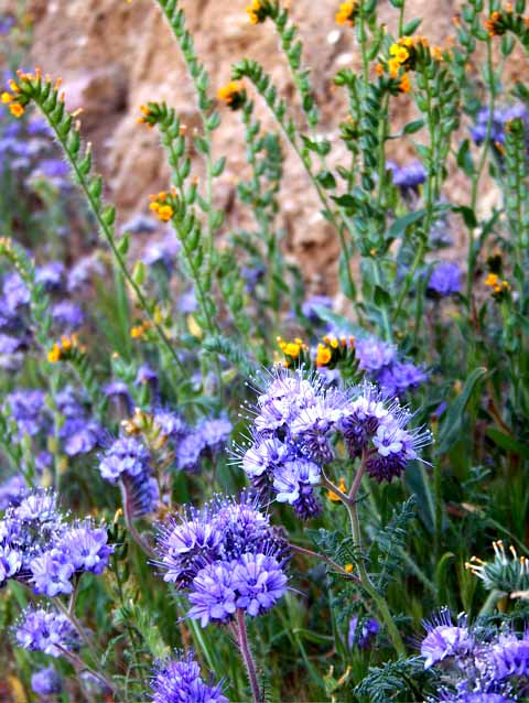
Hwy 58 Phacelia and Amsinckia
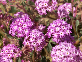
29 Palms Sand Verbena
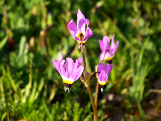
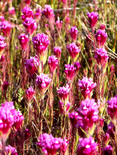
Hwy 58 Shooting stars
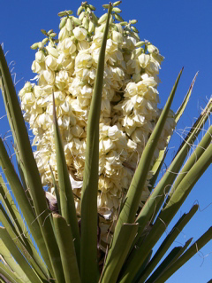
Mojave Yucca
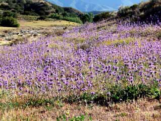
Cal. Hwy 166 Purple Sage
Cal. Hwy. 138 Desert Dandelions
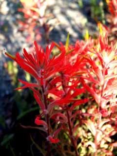
Near Hwy 41 & 46 - Indian Paintbrush
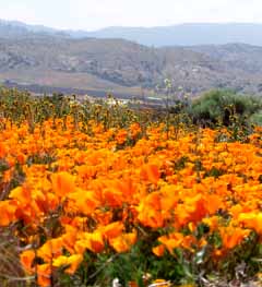
California poppies...
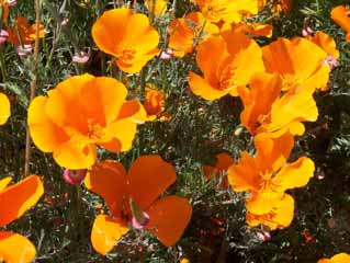
...and more poppies...
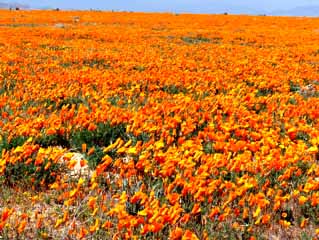
..and still more poppies off Cal. Hwy. 138...
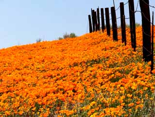
...and even more poppies!
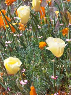 And a single white poppy plant among
100 acres of orange.
And a single white poppy plant among
100 acres of orange.
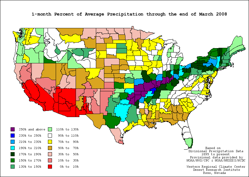 All of California in March and April
suffering a historic drought, when central and southern California
in March got only 0-10% of average rainfall for the month. The
lack of rain causing the exotic annual grasses to start drying
out early, and fire danger to be rated as "Extreme"
in parts of the state by mid-April. Data from
All of California in March and April
suffering a historic drought, when central and southern California
in March got only 0-10% of average rainfall for the month. The
lack of rain causing the exotic annual grasses to start drying
out early, and fire danger to be rated as "Extreme"
in parts of the state by mid-April. Data from
http://www.wrcc.dri.edu/spi/spi.html
All the grasses that turn brown
in the summer in California, are weed grasses from Europe that
kill the native wildflowers. The lack of normal spring rainfall
in 2008 greatly helped the California wildflowers by suppressing
the European exotic annual grasses, and the native wildflowers
grew and bloomed in areas where they had not been seen for decades.
California Hwy 58 transect, west to east, March 2008 (Notebook
215)
What plant we saw, mile-by-mile :
0 = Weeds, European grasses
A = Amsinckia
AG = Agriculture
B = native Bunchgrasses
BB = Baby Blue eyes
BRO = Brodiaea
COR = Coreposis
ET = Elymus triticoides
G = Goldfields
H = native Hordeum grass
L = Lupines
LAY = Layia
LO = Lomatium
ML = Miner's lettuce
MUHL = Muhlenbergia grass
OC = Owls clover
P = California poppies
PHA = Phacelia
RS = roadsides
SC= Stipa cernua
SS = Shooting stars
TOF = native chocolate Paeony (three ovary flower)
V= Yellow native violet
YBP = native Yellow Bush plant
SAN LUIS OBISPO COUNTY
Post miles, Hwy 58, going east, start in town of Santa Margarita:
2 = A @ RS
3 = MULH
4 = A is common
5 = 0 - oaks
6 = 0 - chamise at pass
7 = 0 - Junction 229
8 = 0 - chamise, Chia, BRO, ML, TOF very rare in 1-2 year old
burned chamise, YBP.
9 = 0
10 = 0 - bridge
11 = 0 - Pinus sabiniana
12 = A, G, L, SS valley
13 = 0 - chamise
14 = A, B, L.
15 = A, B, B-Poa, SS
16 = BRO, G, L.
17 = A, L, P
18 = Junction La Panza road, awesome BB, G-10 acres.
19 = A, L
20 = A, P, pines
21 = Junction Shell Creek road, BB, G, Lay
22 = A, B-Poa
23 = A, BB, P
24 = A, L. COR starts
25 = A, G
26 = A, G
27 = 0 - oaks
28 = 0 - oaks
29 = A, BB, COR, G
30 = A, G, P
31 = A, COR, PHA starts, SC
32 = A, COR, G
33 = A, G
34 = A, COR, G
35 = A, G-acres of it
36 = A, juniper
37 = A, L, junipers
38 = A, COR, L
39 = Junction Bitterwater road, AG, A, PHA
40 = 0 - AG
41 = A, AG, PHA
42 = A, AG, PHA
43 = A, AG
44 = A, AG
45 = Junction Soda Lake Road, A, AG
46 = A, AG, PHA
47 = A, COR
48 = A, COR
49 = A, right angle bend in road
50 = A
51 = A - cow chewed
52 = A - cow chewed
53 = 0 - tumbleweeds
54 = A - cow chewed
55 = Junction Seven mile Road, A, COR
56 = COR solid
57 = A
KERN COUNTY AT PASS
1 = A, G. PHA
2 = SOLID COR, PHA, ML
3 = A, PHA
4 = A, PHA
5 = SOLID A, B, SC
6 = A, PHA, first OC
7 = A, B, OC, Locoweed first seen
8 = A, cow chewed
9 = Locoweed, PHA
10 = Locoweed, cow chewed
11 = A, cow chewed
12 = A, cow chewed
13 = A, B, cow chewed
14 = A, shrubs, cow chewed
15 = 0, shrubs, cow chewed
15.20 = 0 - Junction Hwy 33, Near town of McKittrick, California
in Kern County.
See other Dremann Wildflower adventures, 2003,
2009 and 2010
Updated December 24, 2022 - The
Reveg Edge Ecological Restoration service